| |
|
|
Fort St. John (Spanish Fort)
Beauregard St., New Orleans,
LA,
USA
Latitude & Longitude:
30° 1' 23.412",
-90° 5' 1.5468"
|
|

Louisiana State
Historical Marker

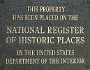
Listed in the National Register of Historic Places |
| |
| |
| |
|
|
Established by Colonial French in the early 18th century. Rebuilt by the Spanish-1779. American restoration-1808. Built to protect New Orleans from attack by way of Lake Ponchartrain.
Last updated: 3/13/2016 18:38 |
|
|
|
| |
|
|
Image Gallery
|
|
|
Fort St. John (Spanish Fort) Historical Marker Location Map, New Orleans, Louisiana
|
|
|


