 |
 |
 |
King William County Courthouse
Courthouse Ln,
VA ,
USA
Latitude & Longitude:
37° 41' 13.805952",
-77° 0' 48.383028"
|
|

Virginia State
Historical Marker

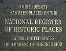
Listed in the National Register of Historic Places |
| |
| |
The King William County courthouse, erected early in the second quarter of the 18th century, is one of the older courthouses still in use in the United States. This T-shaped building was constructed of brick laid in Flemish bond, with an arcade imitating the first capital in Williamsburg. One of the best preserved of Virginia's colonial courthouse buildings, it features fine Georgian brickwork. About 1840 the courthouse was enlarged with a unique stile and a brick wall was erected to enclose the court green. Its rural historic setting is a rare survival.
King William County Courthouse was listed in the National Register of Historic Places on October 01, 1969.
Last updated: 2/14/2015 15:17:00 |
|
|
| |
|
Related Themes: C.S.A., Confederate States of America, Confederacy, Union States
Explore other
Virginia Civil War Historical Markers.
|
Image Gallery
|
|
|
King William County Courthouse Historical Marker Location Map, King William County, Virginia Map
|
|
|


